 Yet again, Run Mania has come up
with an ultra that is rich in history.
Yet again, Run Mania has come up
with an ultra that is rich in history.
This is the Independence Day Ultra
Marathon which takes running fanatics from the Philippine Independence cradle
that is Kawit to the mountains of Maragondon
with graphic names such as Mt. Buntis, Mt. Nagpatong, Mt. Pico de Loro
and Mt. Palay-palay. History aficionados
would no doubt identify one of these mountains (Mt. Nagpatong) as witness to
the execution of the Bonifacio brothers
– Andres & Procopio in May 10, 1897.
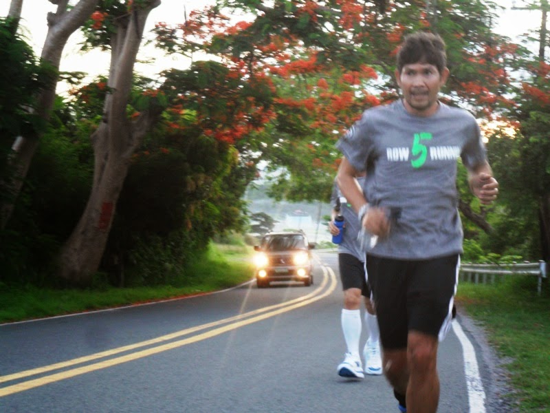
Fast forward to June 9, 2014 and
fellow 83neans Bob, Ed, Ernie and the Bicolano Penguin found themselves on a
recon run of the uphill portion of this 50-km ultra. Based on the map provided in Run Mania’s
website, the first 35 kms of the June 15 ultra are mostly on a flat road. Not withstanding the many errant jeepneys and
swerving motorbikes active on that stretch even in the early bewitching morning
hours, 2/3 of this ultra will be a cake
walk for many of the ultra fanatics.
 |
| 83neans and row5runners: Ernie, Ed, BP and Bob |
It is the last 15 kms that we are
most interested. It is uphill territory
and we are curious if this would be kind of like the first 15 kms of the Rizal
to Laguna Ultra (October 2013), one straight uphill and then one straight downhill
on the national road connecting Pililla
to Siniloan.
At 5am, we were at the bridge in
Ternate leading to the Mt. Palay-palay National Park, having motored from
Paranaque via Carmona Exit and then to Naic-Ternate. This was our starting point. After giving instructions to Orly our driver
to stop every 3 kms, all 4 of us went off on a walk. After passing the village of Sapang which
seemed to be a hotspot for rural religiosity with 3 churches from a different Christian denomination each,
the 83neans went on a run.
 |
| We love... |
 |
| ...the downhill. |
 |
| We struggle and get stronger... |
 |
| ...in the uphill. |
You see, the last remaining
lowland evergreen rainforest in the province of Cavite is on Mt.
Palay-palay. This lush habitat is
reported to cover 60% of the park. As our recon run progressed beyond the 5-km
mark, the abundant frondescence became more evident. Hardwood and fruit-bearing trees abounded on both sides of the road. A handful of fire trees were in full bloom
adding a dash of red to the greenscape.
 |
| Green everywhere... |
 |
| ...inside Mt. Palay-palay National Park |
Not just the flora but the fauna
did its part to make us feel we were in a forest. Approaching a tree with branches hanging on
the road, I could see the foliage moving and some live things making some
sound. At first, I was a bit concerned
as I was by my lone run-walk self as
Ernie and Bob were in full throttle a couple of
kms away while Ed was a km back with his power walking. What if those sound and branch movements are
from a troop of monkeys of the Subic variety. These simians could get nasty on a walking penguin. Good thing, upon a closer look, the sound and
movement were coming from a flock of Rufous hornbill, known locally as kalaw.
Such is the beauty of nature in
the hilly portions of the Independence Day Ultra that in my opinion, the people
behind Run Mania should be given the proverbial
pat on the back. Moreover, it is
not only nature’s wonder that is showcased in the June 15 ultra but also man-made marvels. At roughly the Km 12 mark of our recon run (in the ultra
route, this should be somewhere at Km 47+), we turned left on a short uphill.
This marks our entrance to the newly-built road that connects Cavite to the
Batangas town of Nasugbu. And a
centrepiece of this public transport infra project is the 300-meter long
Caybiang Tunnel.
 |
| Ed turning left on the road going thru Caybiang Tunnel |
 |
| Downhill as we near the tunnel |
 |
| Entering the Caybiang Tunnel |
Entering the wide tunnel, I felt
puny. It was not as dark as that of
the Malinta Tunnel in Corregidor but the sound that is generated by one’s foot
strike gets magnified by the acoustic-like characteristics of the tunnel. Ironically, the puny in me was capable of creating giant-like steps.
 |
| Going... |
 |
| ...out the tunnel... |
 |
| ...still in one piece! |
 |
| Group picture at Caybiang Tunnel |
Venturing out of the tunnel, one
is greeted by a breath-taking view of the cliffs and the blue waters
below. We were actually looking at the
mouth of Manila bay where the island of Corregidor resides. Even the industrial
park across the seas in Mariveles, Bataan can be seen by the naked eye.
 |
| A view of the sea. Mariveles in the background |
No doubt, at this point where the
ultra runners exit Caybiang Tunnel, the
spirit is that of euphoria already as the finish line is just a kilometer away. But a word of caution given that
it is the start of the rainy season already. To the runner’s left would be slopes that could be considered as
landslide prone. Perhaps in the dry summer months, they are not. But now that it has rained for a few days
already, it could be a different picture.
 |
| The slope is very close to the road. |
Thus, the runner could be at a
dilemma. Ultra runners are trained, even mandated, to run against the traffic. This means the runners will be running on the
left lane which is the one closest to the slopes. Given the landslide factor,
would the ultra runner now cross to the right lane where it is a bit farther
from the slopes? It is a food for
thought.
But I have no doubt that given
the Pinoy’s ingenuity in this sort of thing, all runners will be jumping with
joy as they reach the finish line which is a small outcrop (600 square meters
tops) of dry land jutting out to the sea. It is a small piece of land but the ultra runners will be big with their
pride and joy.
 |
| The finish line |
Come June 15, it will be a
colorful fiesta all over again.


2 comments:
I COMMENTED A LONG ONE ON THIS BUT I DONT SEE IT ... WHEW! BUT JUST WANT TO LET YOU KNOW WHAT A GREAT JOB!!! THIS IS AMAZING HOW
YOU PUT EVERYTHING
TOGETHER....MY EXPECTATION HAS
ALWAYS BEEN THE SAME WITH YOU...
A VERY SMART , KIND AND ENERGETIC
PERSON WHO KEEPS UP A VERY GOOD
STANDARD AND YOU MAKE US VERY
PROUD OF YOU... KEEP IT UP! STAY AS
GOOD AS YOU ARE , ALWAYS DO THE
RIGHT THING AND ALWAYS BELIEVE THAT GOD IS ALWAYS NEXT TO YOU. . REMEMBER THAT ..
I COMMENTED TWICE AND LONG ON THIS ONE... GEEEEZ... I DONT SEE IT.. ITDID NOT GO THROUGH BUT ANYWAY JUST TO MAKE IT SHORT, WHAT A GREAT JOB! KEEP UP YOYR ENERGETIC ATTITUDE AND STAY HUMBLE AS ALWAYS. MOST IMPORTANTLY, STAY CLOSE TO GOD BECAUSE BELIEVING IS THE.MOST POWERFUL THERE CAN EVER BE! SO PROUD OF YOU... !!! YOU GOT ME MOTIVATED TO TRAIN FOR A 5 K RUN WITH MY BROTHER JEFF NEXT YEAR... EXPECT US TO RUN TO YOU COZ BY THAT TIME I MIGHT BE SO GOOD AT IT THAT I WILL NEVER GET TO STOP. Hahaha!
Post a Comment